Take your pick: adrenaline packed or slow and contemplative?

THINGS TO DO
Your Townships adventure starts here.
Sports, Nature & Outdoor Activities
Take your pick: adrenaline packed or slow and contemplative?
Arts, Culture & Heritage
Let your imagination run free at galleries, theatres, museums and workshops.
Spa & Wellness
Treat yourself to massages, body treatments, Nordic baths and other sensory delights.
Shopping
Scour our markets, boutiques and other hidden gems to score incredible finds.
Events
Discover our cultural vitality with a wide range of special events.
The Colour evolution
The tree-covered leaves change hues presenting different warmer and warmer and more luminous colours
Cycling
The Townships is a great cycling destination, because it’s designed for pedal power - slow, contemplative, challenging or sporty.
Hiking Trails
Fill your pack with local flavours before setting off to explore the natural beauties that make our region so stunning.
Restaurants
All are sure to please even the most discerning of palates. Bon appétit!
Orchards
Our orchards are overflowing with fruit, all ripe for the picking! Won’t you join us?
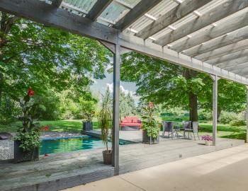
Where to stay
Lodging options to suit any taste and budget.
Hotels & Country Inns
Stunning locations and outstanding service come together for a bliss-inducing stay.
Bed & Breakfasts
Get up close and personal with life in the Townships.
Off the Beaten Path
Think outside the box with out of the ordinary accommodations.
Cottages & Condos
Custom comfort near the city or in nature.
Campgrounds / RV Rentals
Abundant amenities in the heart of nature.
Vacation Centres
Kick back and relax as a family with all-inclusive vacation options.
Other Types of Lodging
Experience something different by choosing unique lodging.
Lodgings with Spa Options
Plan a stay in an accommodation with a private spa or a treatment center. Relaxation guaranteed!
Hikers Welcome
If you, like thousands of visitors annually, plan on hiking in the region, know that your efforts will be rewarded by our world-class hospitality.
Bienvenue Cyclistes
Explore the region on two wheels and stay in one of the many accommodation options bearing the Bienvenue cyclistes icon.
Pet Friendly
Don’t want to leave your four-legged friend behind? Book a stay in some of the region’s many dog-friendly digs and you won’t have to.
The Townships
The Townships possess a rich heritage that you will discover everywhere on its nine territories, in its towns and villages, its Coeurs villageois, etc.
Not to be missed
What is it that draws visitors to the region, year after year? Find out here :
Cœurs villageois
Visit our Cœurs villageois – charming communities that truly characterize the spirit of our region.
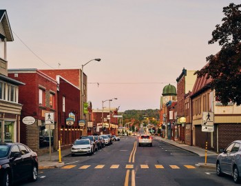
Towns and villages
Explore our lively, welcoming towns and villages with their heritage architecture and fascinating histories.
Nine territories to discover
Each territory has a distinct personality and a wealth of hidden treasures just waiting to be discovered!
The Townships at a glance
Here’s a glimpse of the region, a few historical notions, and numbers.
Tourist routes
Hit the road! The region has several tourist routes designed around different themes – heritage, scenic landscapes, wine….
National and regional parks
Four national and two regional parks – an outdoor paradise in the fresh air, each and every one!
Taste the townships
Here, in so many ways, you’ll enjoy all kinds of gastronomical experiences! When you discover our unique products and our highly renowned tables, you’ll love us forever!
Restaurants
Every time you sit down at one of our tables, you’ll experience a truly special moment. Savour it!
Cafés de village
Visit our Cafés de Village and discover each one’s specialties while meeting the most welcoming and friendly people.
Créateurs de Saveurs Products
You can rely on our food producers who put as much love as delicious flavours into everything they plant and produce.
Vineyards
The Route des vins de Brome-Missisquoi, the Route des vins de l’Estrie, and about twenty other vineyards… The Townships region proudly honours its title of being the first wine region of Quebec.
Microbreweries
The region counts more than twenty microbreweries! Just like the people who run them, each one has established their own strong, unique personality and … extremely inviting character!
Cheese Factories & Dairy Producers
goat’s milk… Here you’ll savour rich artisanal cheeses. Some you already know, many others you’ll enjoy discovering.
Public Markets
Purple peppers, fir honey, pineapple tomatoes … besides all the products you love, sometimes you also discover new, amazingly surprising ones!
Orchards
Our orchards are overflowing with fruit, all ripe for the picking! Won’t you join us?
Restaurants Complices
These restaurants take to heart working with local producers and to offer dishes that integrate certified Créateurs de saveurs products.
Foodie’s Maps
Brasseurs des Cantons and Têtes fromagères are two gastronomical circuits highlighting our microbreweries and cheese factories.
Gourmet Itineraries
Plan your stay by offering yourself a wealth of flavours. Consult our getaway ideas.
Weekend and Trip Ideas
Discover our activities suggestions, getaway ideas and itineraries in the Townships.
Family Outings
Find loads of ideas for memorable family outings!
Romantic Getaways
Outings, restaurants, spas, weekend ideas… Suggestions for spending some precious moments together.
Outdoor Activities
Hiking, kayaking, beaches, cycling… Without a doubt, all outdoor enthusiasts are sure to find something to do here!
Slow Travel
Take the time to take your time in the Townships
Tourist Routes
Vineyards, mountain peaks, heritage sites… Our designated routes make for the most beautiful road trips!
Itineraries
Whether for two, with your family or with friends, here you will find a ton of suggestions for planning perfect getaways!
Experiences to Try
Our collaborators have tested several different adventures … and have approved!
Coeur villageois
Visit our Cœurs villageois – charming communities that truly characterize the spirit of our region.
Towns and Villages
Explore our lively, welcoming towns and villages with their heritage architecture and fascinating histories.
Guide and Maps
View our guide and maps online or order your free copies.
Published on Jun 4, 2024
We all know, the Eastern Townships region offers a multitude of hiking trails. While some require an entrance fee, many others are accessible free of charge. Here are 18 destinations where you can hike without spending a dime.
Psst! Voluntary contributions are always appreciated in order to help keep the trails in good condition. The maintenance of many networks depends largely on donations.

Nature, sports and outdoor activities
Family-Friendly Hikes in the Eastern Townships
Nature, sports and outdoor activities
This Summer’s Ultimate Activity Guide to Do Among Friends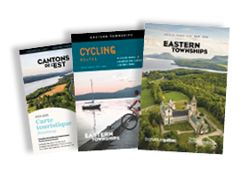
© 2024, Tourism Eastern Townships. All rights reserved.

Filters
X